IMD forecast Rain, thunderstorm in Himachal, issues orange & yellow alerts


Photo of Friday weather map used for indicative purpose only
IMD forecast Rain, thunderstorm in Himachal, issues orange & yellow alerts
Shimla, June 17,
Rain and thunderstorm activity might intensified across Himachal Pradesh on Wednesday beginning of an active pre-monsoon spell in the state.
The India Meteorological Department (IMD) has issued orange and yellow alerts for several districts, warning of heavy rainfall, thunderstorms, lightning, hailstorms and strong winds over the next few days. Wind speeds of up to 40-50 kmph are likely in Shimla, Kullu, Mandi, Chamba, Kangra, Solan and Sirmaur districts.
The weather department said light to moderate rain accompanied by thunderstorms and lightning is likely at many places during the afternoon hours. The present weather activity is being caused by a western disturbance and cyclonic circulations affecting north-western India.
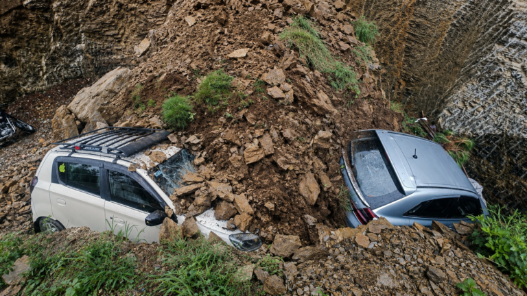
The recent spell of hailstorms has already caused damage to standing crops, vegetables and fruit orchards in several mid-hill and lower hill areas of the state. Farmers and orchardists have reported losses due to strong winds and hail.
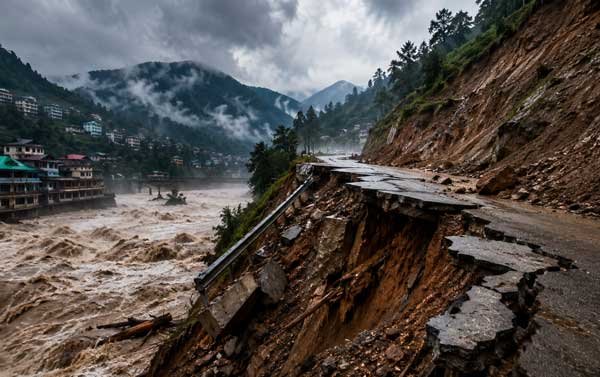
Meanwhile Bhakra Beas Management Board (BBMB) has issued an alert for areas along the Beas River after increased snowmelt and rainfall in the river catchment.
About 4,000 cusecs of water is expected to be released from the Pandoh Dam, which may lead to a sudden rise in the water level and flow of the river downstream.
Residents of Mandi, Kangra and Hamirpur districts have been advised to remain vigilant and stay away from river banks and riverbeds. The BBMB has warned people against walking, photography, fishing and other activities near the river as the water level may rise suddenly.
Also Read IMD signals relief from intense heatwave, forecasts early monsoon onset
Contractors and labourers working in the river have been directed to shift machinery and equipment to safer locations on higher ground. Officials said the situation is being monitored continuously and further advisories will be issued if the discharge from the dam is increased.
The administration has also appealed to tourists to avoid visiting river banks for selfies and photography. Authorities said many visitors continue to enter vulnerable areas despite warnings, putting their lives at risk.
The latest rainfall has brought a sharp drop in temperatures across the state. Maximum temperatures have fallen by several degrees, ending the heatwave conditions that prevailed during the past week.
Meteorologists said the southwest monsoon is advancing at a normal pace across the country. If present conditions continue, monsoon is expected to reach Himachal Pradesh after about a week, bringing more widespread rainfall to the state.
Officials have advised people to remain indoors during thunderstorms, avoid taking shelter under trees and follow weather advisories issued by local authorities.
It is worthwhile to mention that about eight to nine days are left to arrival of South West Monsoon system in the state. In long term forecast IMD project arrival of monsoon around June 25 to 26 tentative date of arrival of rainy season in North West Himalaya.