Successive WDs could shape HP’s winter; snowfall remains a possibility
Shimla, Updated Oct 27,
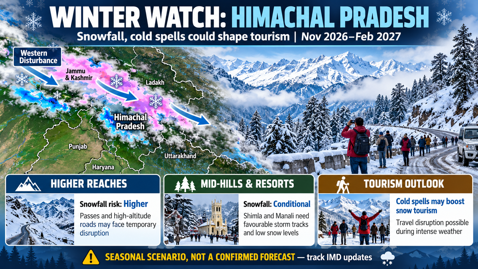
Himachal Pradesh could see a change in weather towards the end of October, with an approaching Western Disturbance likely to bring isolated rain and snowfall in higher reaches. Whether this marks the beginning of a more active winter will depend on the frequency, intensity and movement of subsequent weather systems across the western Himalayas.
The India Meteorological Department’s latest forecast, issued on October 27, indicates the possibility of thunderstorm-related activity in parts of Himachal Pradesh on October 29 and 30. Weather conditions are expected to remain largely dry on October 27 and 28, with no warnings issued for these two days. Light to moderate rain and isolated snowfall are possible under the influence of the approaching system, although the extent of precipitation and the areas receiving snow will depend on its movement.
The immediate weather change comes as the state moves towards the winter season, when Western Disturbances become a major source of precipitation over the Himalayan region. These weather systems transport moisture from the Mediterranean region and adjoining areas towards north India, bringing rain to the middle and lower hills and snowfall to higher elevations when temperatures and atmospheric conditions are favourable.
Successive disturbances hold the key
The broader winter outlook for November 2026 to February 2027 will depend largely on how frequently these systems affect the region. If successive, moisture-bearing Western Disturbances cross the western Himalayas at short intervals, they could produce concentrated spells of snowfall in the higher reaches of Lahaul-Spiti, Kinnaur, Chamba and Kullu.
Such a sequence could replenish mountain snow cover, intensify cold conditions in high-altitude valleys and temporarily affect road connectivity over mountain passes. Depending on the altitude of the freezing level and the strength of individual systems, parts of the middle hills, including Shimla and its adjoining areas, could also experience snowfall.
However, successive disturbances are a possible winter scenario, not an established forecast for the entire season. Their frequency, intensity and exact tracks cannot yet be reliably determined several months in advance.
November could bring further changes as winter conditions gradually establish themselves. December and January are generally important months for snowfall in Himachal Pradesh, but the timing and distribution of precipitation vary considerably from year to year. Even during an active winter, periods of dry weather can separate major snowfall events.
Regional climate outlook signals warmer temperatures
The broader climate outlook also calls for caution against assuming that an active snowfall season would necessarily mean a persistently colder-than-normal winter.
The World Meteorological Organization, in its South Asian Climate Outlook issued on October 14, indicated normal to above-normal rainfall over northwestern and several other parts of South Asia during October-December 2026. The outlook also favoured normal to above-normal maximum and minimum temperatures over most of the region.
The outlook is regional in scope and does not constitute a specific prediction of snowfall, cold-wave conditions or winter precipitation totals for Himachal Pradesh. It therefore cannot be used on its own to establish whether the state will experience an unusually snowy or severe winter.
Meteorologically, warmer seasonal temperatures and substantial snowfall are not mutually exclusive. A strong Western Disturbance can generate heavy precipitation over higher mountain ranges even within a generally warmer climate. Conversely, prolonged dry conditions can leave mountain areas with limited fresh snowfall despite cold nights.
What to watch in the coming weeks
The development of the winter pattern will become clearer as weather models provide more specific information about incoming Western Disturbances, moisture availability, freezing levels and the expected duration of precipitation.
For residents, farmers and tourists, the immediate focus should be on updated forecasts for October 29 and 30, particularly for travel to high-altitude areas. Even limited early-season snowfall can affect road conditions at higher elevations, while rainfall and thunderstorms may temporarily disrupt outdoor activities.
The possibility of further snowfall during November and the following winter months will need to be assessed through successive IMD forecasts rather than extrapolated from a single weather system.
About the Author

Himachal ki har badi khabar, sabse pehle aapke paas
Breaking news, local updates aur exclusive stories — seedha WhatsApp ya Email par. Free. No spam.
WhatsApp Alerts
Instant news seedha aapke phone par. Ek click me subscribe karein.
Subscribe on WhatsAppEmail Newsletter
Har nayi post ka link aapke inbox me. Kabhi bhi unsubscribe karein.