Photo used for indicative purpose only. Source: Internet
Shimla, June 4,
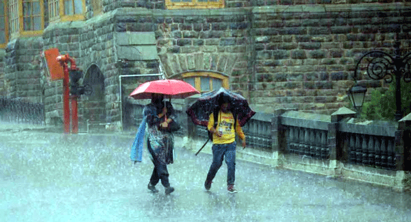
A fresh spell of pre-monsoon activity swept across Himachal Pradesh over the last 24 hours, bringing widespread thunderstorms, lightning, and light to moderate rainfall, resulting in a noticeable drop in maximum temperatures, according to the Meteorological Centre Shimla. The Indian Meteorological Department has issued an orange alert for seven districts on Wednesday and Thursday. Overnight pre-monsoon rains accompanied by lightning and thunderstorms partly affected power supply, traffic, and communication in the state.
The lowest recorded minimum temperature was in Keylong, where the mercury dipped to 4.4 degrees Celsius, which is 2.6 degrees below the normal level for this time of year. The capital city Shimla experienced a significant temperature drop, with the minimum temperature recorded at 9.2°C, which is 7.2 degrees below normal. Other locations such as Kalpa and Manali also saw temperatures fall below their usual levels, with Kalpa at 6.5°C and Manali at 10.3°C, both registering a decline of over one degree from their respective normals.
Several towns in the region also experienced below-normal minimum temperatures. Solan and Sundernagar recorded 13.8°C and 15.1°C respectively, marking a drop of 3 to 4 degrees below average. Mandi’s minimum temperature was 15.5°C, almost four degrees below the normal range. In the lower hills and plains, Nahan registered 17.3°C, which is 6.1 degrees lower than usual. Similarly, Dharamshala stood at 17.4°C, Kangra at 15.4°C, and Una at 16.5°C, all showing a marked reduction from seasonal averages. Bilaspur recorded 17.9°C, down by nearly 4 degrees, while Palampur saw a temperature of 13.5°C, which is 6.4 degrees below normal. Jubberhatti reported 11.8°C, and Paonta Sahib and Barmaur recorded 18.0°C and 10.0°C, respectively.
This statewide drop in minimum temperatures is linked to the ongoing western disturbance and the associated thunderstorm activity, with most mid and high hill areas experiencing temperatures 3 to 7 degrees below normal for this period. Rainfall amounts recorded in various locations included 64.1 mm in Karsog, 45.0 mm in Kufri, 40.2 mm in Shimla, 39.4 mm in Malraon, 37.0 mm in Ghaghas, and 28.6 mm in Bilaspur. Gusty winds were reported in Neri at 67 km/h, Bilaspur at 57 km/h, and Dhaulakuan at 44 km/h, while thunderstorms affected Shimla, Jubberhatti, Sundernagar, Bhuntar, and Kangra.
The IMD has also issued a yellow warning for isolated thunderstorms accompanied by lightning and gusty winds reaching speeds up to 60 km/h on June 4 and 5. Following this, dry weather is expected to return to most parts of the state. The forecast predicts a gradual warming trend; however, authorities have cautioned about localized impacts from thunderstorm activity such as waterlogging, traffic disruptions, and possible damage to weak structures.
Residents are advised to remain indoors during lightning events, secure loose objects around their homes, and adhere to local safety advisories. The current weather pattern is attributed to a persistent western disturbance combined with a cyclonic circulation over Punjab and surrounding areas, supported by atmospheric troughs in the mid and upper troposphere. This weather system continues to influence Himachal Pradesh’s climate, bringing further rainfall to parts of the mid and high hills in the coming days.
About the Author
![]()
The HimachalScape Bureau comprises seasoned journalists from Himachal Pradesh with over 25 years of experience in leading media conglomerates such as The Times of India and United News of India. Known for their in-depth regional insights, the team brings credible, research-driven, and balanced reportage on Himachal’s socio-political and developmental landscape.